Orignal publication by Angely Mercado for gizmodo.com on 12 October 2022
This is probably an underestimation of the PFAS-contaminated areas, according to researchers.
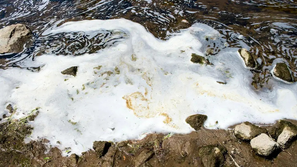
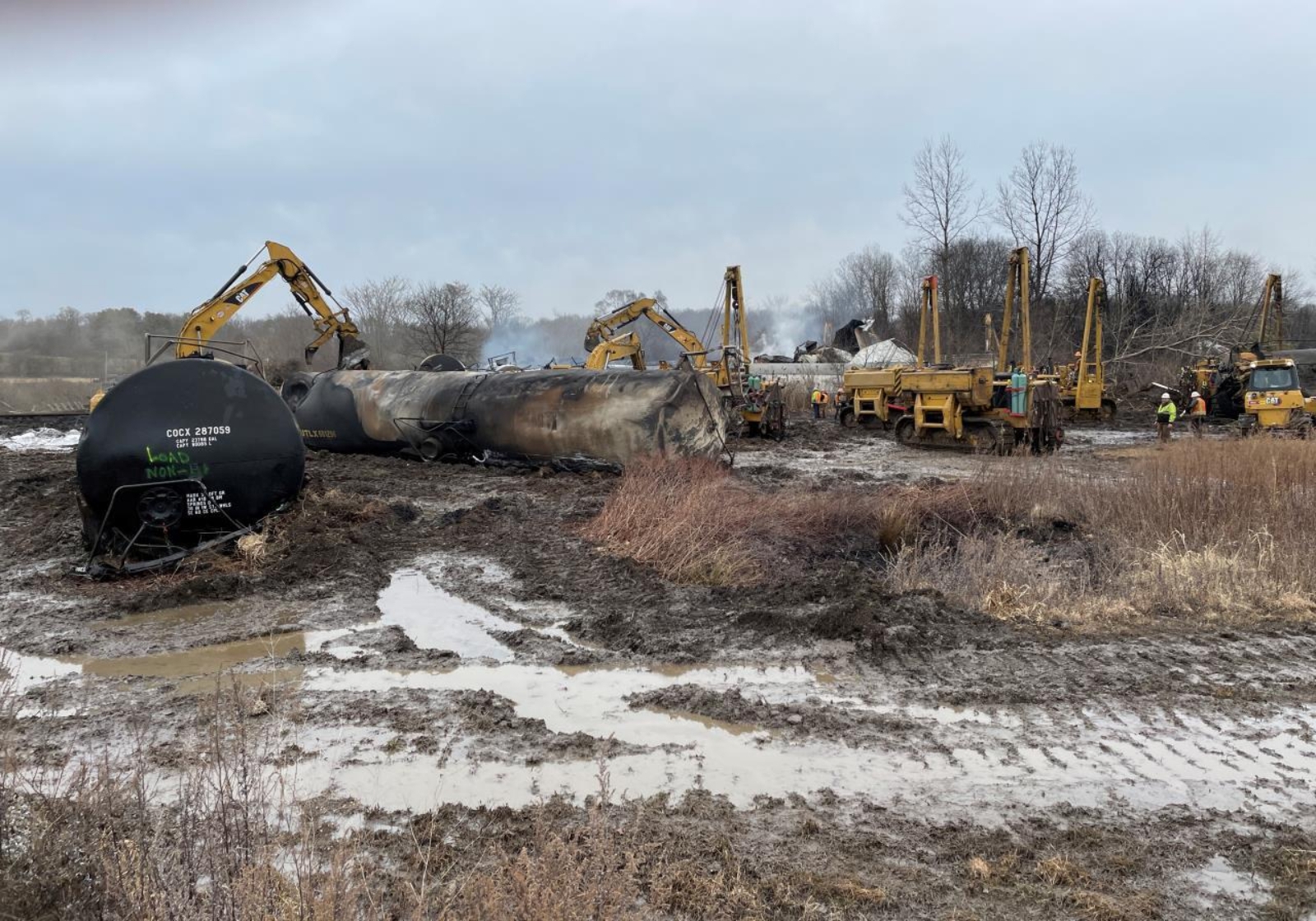
Photo: Jake May/The Flint Journal (AP)
Researchers have determined that the country is dotted with tens of thousands of locations that may be contaminated by PFAS, which are per- and poly-fluoroalkyl substances—aka forever chemicals that do not disintegrate over time in nature or in the human body. Now, they’re mapping those sites to help regulators better direct resources toward cleanup efforts.
A new study published today in Environmental Science & Technology Letters estimates that there are over 50,000 PFAS-contaminated sites throughout the United States. The researchers argued that in the absence of testing data, they can presume contamination based on three categories of facilities that are very likely to be contaminated with PFAS chemicals.
“What we’re arguing is, if you don’t have high quality data you should approach these sites assuming that there is PFAS contamination,” Alissa Cordner, Associate Professor of Sociology at Whitman College and a senior author of the study, told Earther.
The team looked at publicly available data on industrial facilities, locations where firefighting foams have been used, and sites related to PFAS-containing waste. They identified 57,412 sites of presumptive PFAS contamination throughout the 50 states and the District of Columbia. This included 4,255 wastewater treatment plants, 3,493 current or former military sites, 49,145 industrial facilities, and 519 major airports.
“While it sounds scary that there are over 57,000 presumptive contamination sites, this is almost certainly a large underestimation,” said Phil Brown, director of Northeastern University’s Social Science Environmental Health Research Institute and co-author on the paper, in a statement. “The scope of PFAS contamination is immense, and communities impacted by this contamination deserve swift regulatory action that stops ongoing and future uses of PFAS while cleaning up already existing contamination.”
Despite the growing alarm and awareness of the chemicals, it’s difficult to understand the scale of PFAS contamination in the country. Cordner explained that one main motivation for the study is how little federal data there is on PFAS contamination. It is expensive to test for PFAS contamination, so smaller government agencies or local and state organizations may not always have the funds to do a thorough analysis. But a map of specific locations that are likely contaminated can give agencies a way to approach testing in a more targeted and efficient manner.
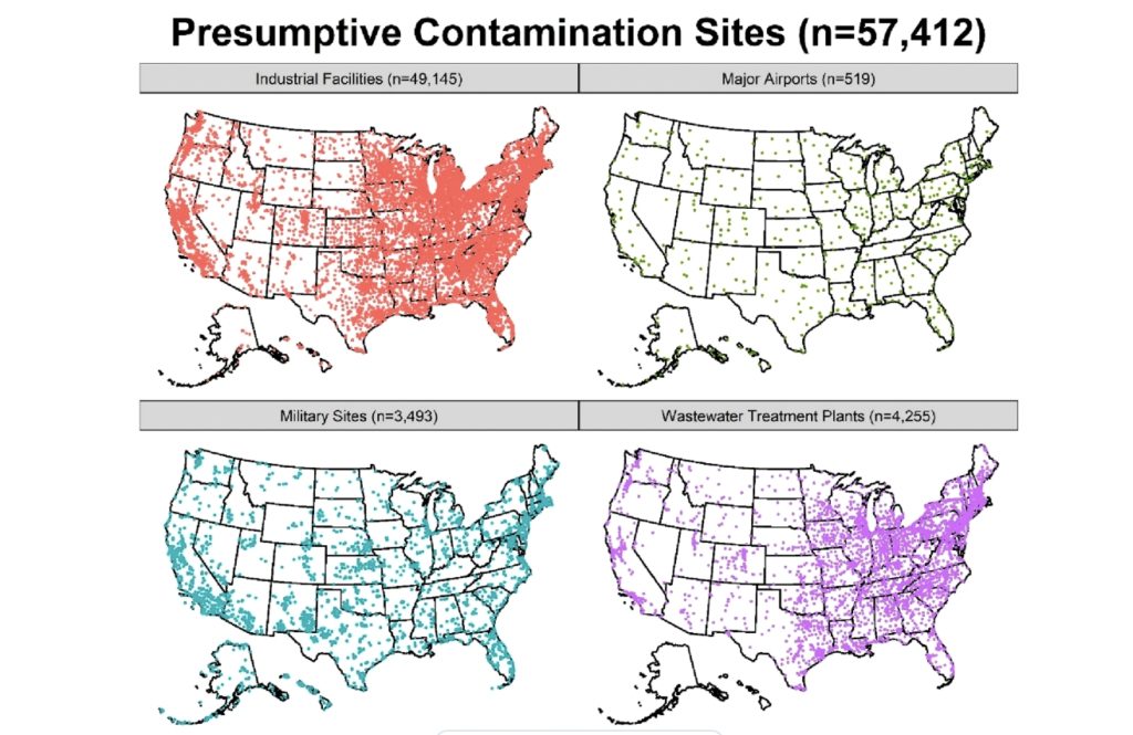
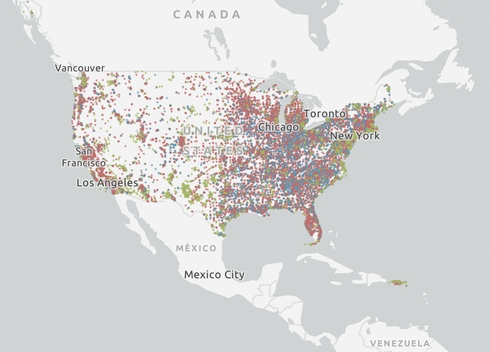
Illustration: Environmental Science & Technology Letters
PFAS is a growing concern in America. They’re a group of over 12,000 chemicals that are widely used in both consumer and industrial products. They’re also in plastics and in cosmetics—especially in items like waterproof mascara. The chemicals are also found in fracking sites. These chemicals persist in the environment and in human bodies and do not break down over time. Researchers have linked the exposure of these chemicals to cancer, infertility, and even liver health issues. The chemicals can contaminate the air and soil, and travel via water. The researchers compiled the data into an interactive map that shows tens of thousands of dots all over the U.S. that represent the presumptive contamination sites. Many are especially clustered around major cities like Chicago, Detroit, New York, and Boston.
Despite the growing concern, there is little regulation. The U.S. Environmental Protection Agency has developed water health advisories for four PFAS, including updating advisories for PFOA and PFOS at “near zero” levels. 19 states have placed some limits on PFAS levels in drinking water, but there is still no federal limit.
Cordner hopes that this data will push policymakers and different environmental agencies to create more PFAS regulations and boost public awareness of these chemicals. “We also think the model can be useful to folks who maybe aren’t regulators or researchers, but are concerned about PFAS contamination in their communities,” she said. “[The map] can help them identify likely sources near them, and then they can ask questions about what those companies are doing.”